We provide a broad range of specialist services and reports to support residential, rural and land development projects from the earliest feasibility stage through to approval and implementation.
Our work is practical, approval-focused and grounded in the realities of land capability, environmental constraints and planning compliance. Whether you are assessing a property before purchase, preparing a Development Application, designing on-site wastewater, investigating contamination, or coordinating technical inputs for a subdivision, we help you move forward with clarity and confidence.
We do not believe in generic reports or unnecessary work. Our role is to identify what is relevant to your site, your proposal and your approval pathway, then prepare clear, well-supported documentation that adds value to the project.
Pre-Purchase/Development Reports

Buying or developing property can be complex, especially where planning controls, environmental constraints and land capability issues are not obvious at first glance. A site may appear suitable, but the real question is whether it can be used, developed or approved in the way you intend.
Our fixed-price Pre-Purchase and Pre-Development Reports are designed to give you that clarity before major decisions are made. We assess what planning controls apply to the land, what types of development may be permissible, what key environmental or physical constraints exist, and what approval risks may affect cost, timing or feasibility.
This service is ideal for clients considering the purchase of rural or residential land, clients seeking to understand the development potential of a property they already own, and clients wanting an early, informed view of whether a proposal is realistic, high risk or not feasible in its current form.
As part of this process, we undertake a preliminary desktop assessment of the property, including relevant planning controls, cadastral and topographic information, known hazards, land use constraints, and available soil and landscape information. The objective is to identify what matters early, before money is committed in the wrong direction.
You receive a concise written report together with a clear site plan identifying likely constraints, setbacks, and potential building or development areas. Where appropriate, we also identify the specialist consultant inputs that may be required if the project proceeds to Development Application stage.
This service is about reducing uncertainty. It gives you an informed basis for purchase, design, due diligence and project planning — and, just as importantly, helps you avoid costly assumptions.
Subdivisions
Subdivision is far more than a numerical exercise. Today, meeting a minimum lot size is the smallest part of a Subdivision DA that is practical, compelling and likely to be approved.
We assist with subdivision projects by assessing the real capability of the land and shaping lot layouts that work in planning, environmental and commercial terms. This includes the council-mandated consideration of slope, access, frontage, servicing, wastewater areas, solar orientation, topography, future building envelopes, surrounding development pattern and local landscape character.
A well-designed subdivision should produce lots that are usable, attractive and capable of supporting future development without avoidable constraints. Poorly configured lots may meet a technical minimum but still create approval issues, infrastructure inefficiencies or reduced market value. Our role is to help avoid those outcomes by looking beyond the numbers.
We support subdivision projects through early feasibility advice, site analysis, spatial mapping, environmental constraints review, wastewater and contamination considerations, and coordination of the planning and technical inputs needed to support a complete ‘approval-ready’ package.
Development Applications
We help clients navigate the complex and sometimes overlapping requirements of planning legislation, local controls and technical assessment standards.
Our work on your Development Application is built around an approval-focused process. We begin by identifying the relevant planning pathway, confirming permissibility, understanding the site constraints, and then coordinating the reports, plans and supporting material required to present a clear and ‘approval-ready’ DA to Council.
We support clients in identifying suitable building locations for houses, sheds, greenhouses and other rural or residential structures by considering slope, aspect, soil conditions, access, setbacks, hazards, servicing and environmental constraints. The aim is not simply to show that something can fit on a site, but to demonstrate that it has been located and designed in a way that is practical, compliant and responsive to the land.
We can prepare or coordinate key technical inputs including wastewater system design, soil testing, contamination-related assessments, stormwater and erosion management, landscaping concepts, and location and site plans based on spatial, cadastral and field data.
Where specialist reports are required outside our in-house scope, we work closely with a trusted network of well-qualified and experienced external experts to coordinate additional inputs such as ecological assessments, vegetation management plans, geotechnical advice, architectural drawings, heritage inputs and survey plans.
Our role is to bring these components together into a coordinated approval package that is clear, consistent and designed to minimise any avoidable delays.
Stormwater Reports
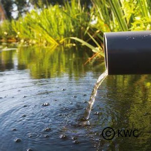
Stormwater is a critical part of development design, particularly on constrained sites and within sensitive catchments. Poor stormwater planning can create erosion, downstream impacts, water quality issues and approval delays, even where the broader development proposal is sound.
We prepare our stormwater reports based on WaterNSW‘s modelling tools to support Development Applications and the related approval processes. Our work focuses on demonstrating that runoff can be managed appropriately, that water quality impacts are ‘Neutral or Beneficial’ (NorBE), and that the proposed development responds to relevant technical and catchment requirements.
For smaller developments, we can assist with the assessment and documentation of stormwater impacts using recognised small-scale (S3QM) modelling tools and practical stormwater treatment measures. For larger or more complex developments, we can support conceptual stormwater design and water quality assessment using more advanced modelling tools (‘Model for Urban Stormwater Improvement Conceptualisation – MUSIC) and consultant coordination.
Where development is located within the Sydney drinking water catchment, stormwater design must often do more than satisfy standard building sustainability requirements. It may also need to demonstrate a Neutral or Beneficial Effect on Water Quality through appropriate treatment, management and supporting documentation. We understand the practical and strategic importance of this requirement and help clients address it early.
Our stormwater work is integrated with broader site planning, wastewater, erosion and sediment control, and water cycle management considerations so that the final package is technically coherent rather than fragmented.
Wastewater Reports
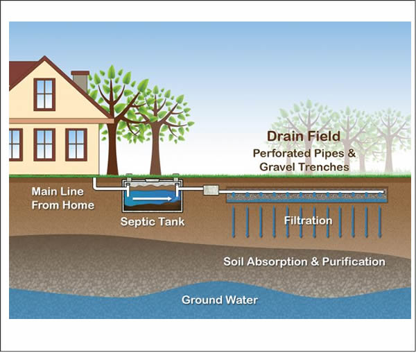
Where a property is not connected to a reticulated sewer system, development will generally require a properly designed on-site wastewater management system. This is a critical part of site suitability and often one of the most important technical constraints affecting rural and semi-rural development.
We provide wastewater assessment and design services for residential and rural developments, with a strong focus on land capability, soil performance, site constraints and approval compliance. Our work helps determine what type of system is suitable, where it can be located, how it can be managed on the land, and whether sufficient area and separation distances are available.
On-site wastewater systems vary significantly depending on site conditions and treatment level. Some sites may be suitable for conventional systems, while others require more advanced treatment and disposal solutions due to soil permeability, slope, shallow rock, limited land area, groundwater sensitivity or other constraints. On-site wastewater designs can be categorised into three treatment systems – primary, secondary, and tertiary:
Primary treatment systems provide the most basic level of wastewater treatment by separating solids and liquids. Common examples include septic tanks and composting toilets. These systems usually require soil absorption below ground and are only suitable where there is enough suitable soil depth, adequate permeability and favourable landform. Typical disposal methods include absorption trenches, beds and sand mounds.
Secondary treatment systems use biological processes to further treat wastewater, producing effluent suitable for subsurface irrigation in many cases. This involves distributing treated wastewater below ground to the root zone of plants through a network of pipes. System design depends on wastewater volume, available area, soil type and site constraints. Aerated wastewater treatment systems are a common example.
Tertiary treatment systems provide an even higher standard of treatment by adding processes such as membrane filtration or UV disinfection. These systems are generally used where site constraints or environmental sensitivity require higher-quality effluent. Surface irrigation may be possible for some tertiary treatment systems – however, it is more tightly controlled and may not be supported by some councils due to reliability, public health and compliance concerns.
We assess the relationship between wastewater volume, treatment standard, disposal method, soil profile, landscape position and available effluent area to determine an appropriate and credible design response. This may include advice on primary, secondary or higher-level treatment systems and disposal options such as soil absorption, subsurface irrigation or other suitable land application methods.
Good wastewater design is not only about regulatory compliance. It is about protecting human health, preserving land and water quality, and ensuring the proposed development can function safely and reliably over the long term. Our reports are prepared with that broader objective in mind.
Environmental Sampling and Analysis
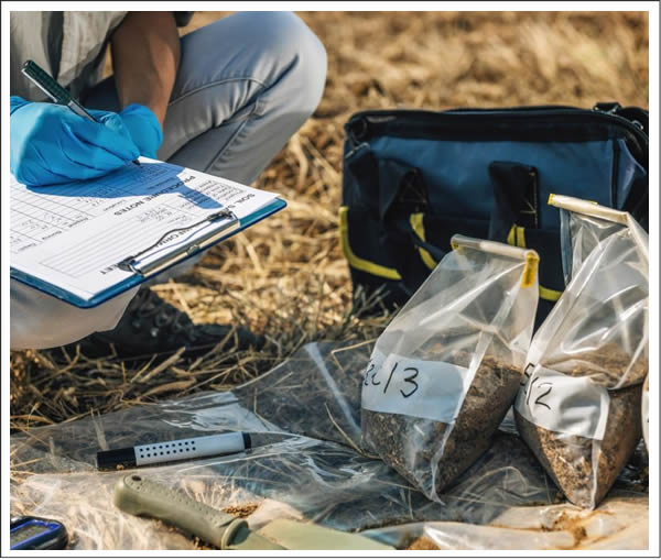
Soil and water testing can play a critical role in understanding land capability, environmental risk, contamination, agricultural performance and suitability for development.
We provide environmental sampling and analysis services to assess the biological, chemical and physical properties of soil and water. Depending on the project, this may include testing to inform fertility and land management decisions, identify erosion or drainage limitations, assess wastewater suitability, investigate contamination risk, or support resource recovery and waste classification requirements.
Where contamination is suspected or known, we assess site history, land use change, potential contaminant sources and the environmental setting to determine the appropriate investigation pathway. This may include the development of conceptual site models, targeted sampling programs, and reporting consistent with recognised contaminated land assessment practice.
We support a range of contaminated land and site investigation services, including Preliminary Site Investigations (PSI), Detailed Site Investigations (DSI), Remedial Action Plans (RAP), validation and verification work, and waste classification. Our work is structured to provide clear, compelling information that can support planning decisions, remediation strategies and regulatory compliance.
We also recognise that land management history can have lasting impacts on soil performance, water movement, fertility and landscape resilience. Our broader land assessment work is informed by long-term thinking about soil health, regenerative land management and the relationship between land use practices and environmental condition.
All laboratory analysis is undertaken through established, reliable and NATA-accredited specialist laboratories.
Resource Recovery
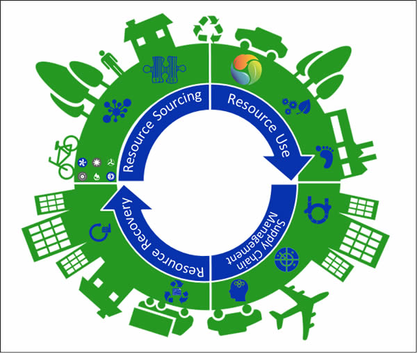
Resource recovery is the process of turning suitable waste materials into valuable and lawful inputs for beneficial re-use, reducing the need for disposal and supporting better use of finite resources.
In land development and site works, this often involves soil and other recovered materials that may be capable of lawful re-use where they meet the relevant requirements for classification, traceability, testing and environmental suitability.
We assist clients in navigating the assessment, testing and reporting required to determine whether materials can be reused appropriately and lawfully. This includes site management planning, validation and verification processes, waste classification, and documentation aligned with the relevant NSW resource recovery framework.
Our approach is practical but careful. Re-use can create environmental and commercial value, but only where the material is suitable, properly characterised and able to be used without creating contamination risk, land degradation or regulatory breach. We do not support assumptions or shortcuts in this area. Materials must be understood, verified and matched to the intended use.
Where suitable source information, testing and chain of custody can be established, recovered soil and related materials may offer a sensible alternative to disposal and a valuable input for site development or landscape works. Our role is to help ensure that any such pathway is properly supported by evidence and documentation.
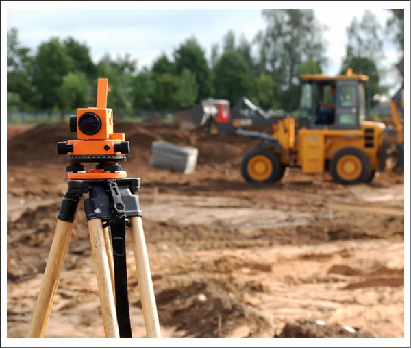
Geographical Information Services and Mapping
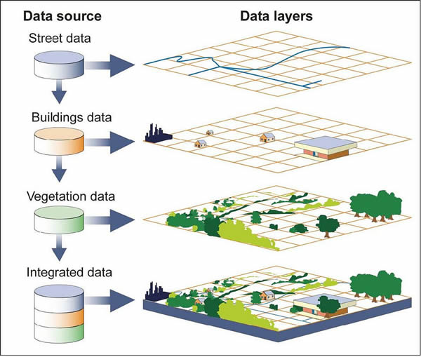
Spatial analysis is a core part of how we understand land and support better development decisions.
We use Geographic Information System (GIS) technology and in-house environmental drafting to integrate multiple layers of site information into a clear and usable planning picture. This allows us to assess properties holistically rather than relying on isolated data points.
Our mapping work can include cadastral and topographic information, aerial imagery, digital elevation models, soils data, planning controls, environmental constraints, hazards, servicing considerations, consultant data and field observations. By combining these sources, we can identify the physical and regulatory factors that shape what can realistically occur on the land.
GIS supports a wide range of our work, including site analysis, building location assessment, subdivision layout, wastewater planning, contamination investigations, stormwater strategy, constraint mapping and Development Application documentation.
The value of this approach is simple: better information leads to better decisions. Spatial analysis helps us see how the land functions, where the opportunities are, and what needs to be addressed early to support a smoother approval pathway.
So what now?
Good projects begin with clear advice.
Our team brings together a wide range of in-house capabilities across soil science, planning support, environmental assessment, GIS and project coordination. We also work closely with well-qualified, experienced and trusted external specialists when additional expertise is required, allowing us to assemble the right team for the needs of each project.
When you engage us, you are not just commissioning a report. You are engaging a professional team that understands how land, regulation, science and approval strategy fit together — and how to turn that understanding into practical outcomes.
The first step is usually a conversation. We can meet on site, by phone or online to understand your property, your goals and the issues that may affect the project. From there, we can advise on the likely pathway, the key risks, and the most effective next steps.
Contact us for a completely obligation-free initial discussion about your ideas: 1300 729 307 or
We will then do completely free meeting on-site, by zoom or by phone to explore how we could help you.